Area dell'identificazione
Codice di riferimento
PDM-01-60274
Titolo
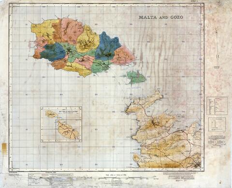
Map of Gozo and part of Malta - Surveyed from the photographs by the Geographical Section, General Staff, and by the Ordnance Survey
Date
- 1934 (Creazione)
Livello di descrizione
Unità documentaria
Consistenza e supporto
One Map size:950 x 771 in Paper (Heavy)
Area del contesto
Nome del soggetto produttore
Nota biografica
Storia archivistica
Map of Gozo showing coloured locations of the different localities including Comino and Part of Malta up to part of the Victoria Lines and Musta - Photographed from the air by the R.A.F. in 1927
Modalità di acquisizione
Area del contenuto e della struttura
Ambito e contenuto
Gozo - Architect: Ordnance Survey
Valutazione e scarto
Incrementi
Sistema di ordinamento
Area delle condizioni di accesso e uso
Condizioni di accesso
Condizioni di riproduzione
Lingua dei materiali
Scrittura dei materiali
Note sulla lingua e sulla scrittura
Caratteristiche materiali e requisiti tecnici
Physical Condition: Good; Staining: FALSE; Creasing or wrinkling: FALSE; Torn edges / corners: FALSE; Torn through centre of drawing: FALSE
Strumenti di ricerca
Area dei materiali collegati
Esistenza e localizzazione degli originali
Drawer 6
Esistenza e localizzazione di copie
Unità di descrizione collegate
Area delle note
Nota
Original Reference No: 3859 - Sheet 1
